The Hamakua Coast Drive Is Half the Reason to Come
Hilo to the falls road the slow way: the Onomea four-mile scenic route, Honomū's wooden storefronts, and the gulches of the old sugar coast.
 By Kekoa Kalani, Akaka Falls tour guide and island nature specialist
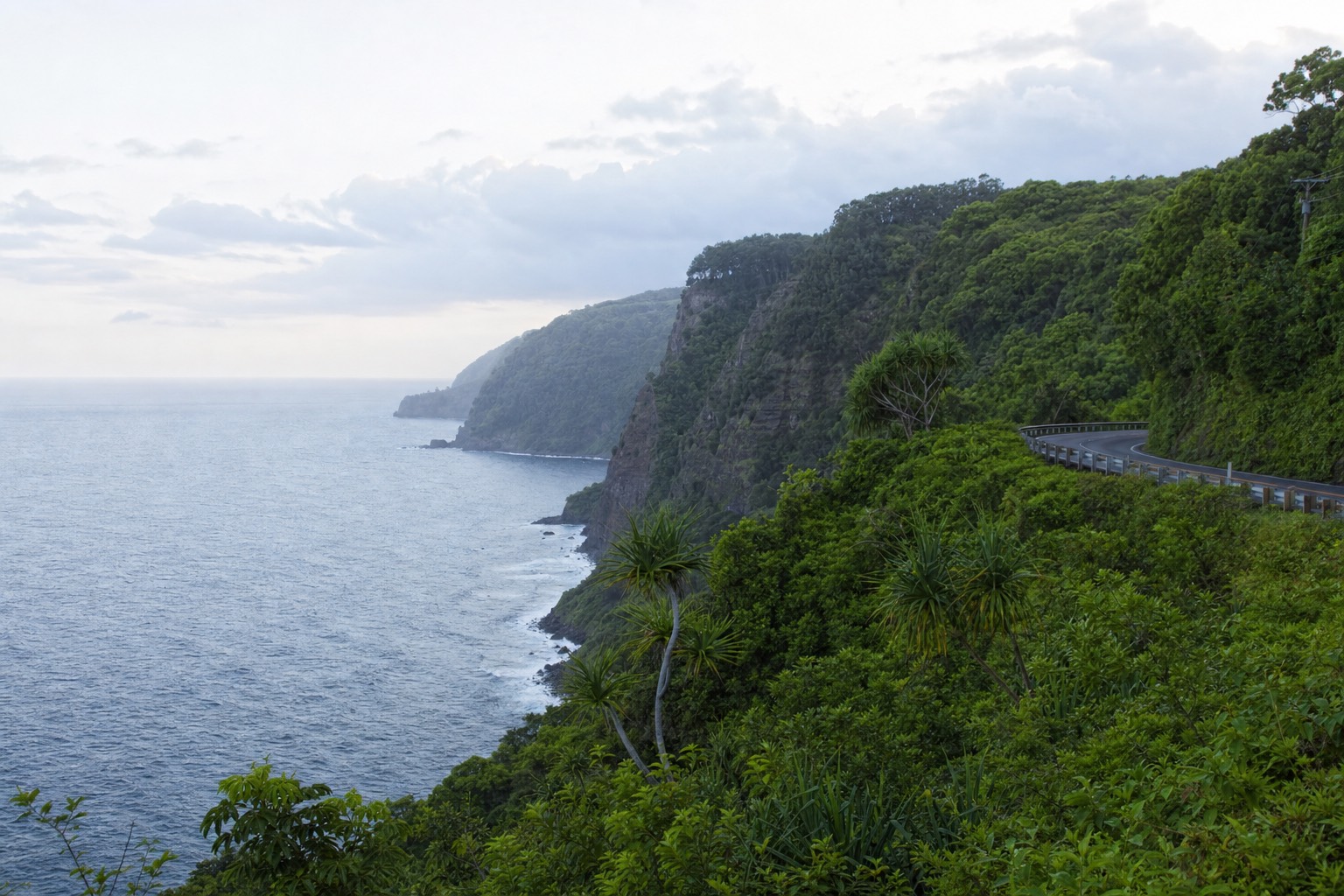
There is a moment about ten minutes north of Hilo where Highway 19 crests a gulch, the trees open, and the Pacific appears below you looking less like scenery and more like a threat. Guests go quiet at that spot. I have driven this stretch more times than I could invoice, guiding people up to ʻAkaka Falls since 2015, and the coast still does that to me on the right morning.
The falls are the destination. Fine. But the Hamakua Coast is the part of the day that visitors bring up at dinner, and it deserves to be driven like it matters rather than crossed like a parking lot approach.
Leaving Hilo, and the turn most people miss
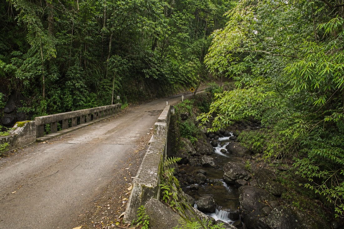
The drive proper starts where Highway 19 leaves Hilo's bayfront and climbs north. Almost immediately there is a decision, and it is the most important one of the morning: a signed turnoff just north of town for the Onomea Scenic Drive, a four-mile loop of old coastal road that the official Hamakua Heritage Corridor route treats as the opening act. It is narrow, mossy, and slow, which is the point. The state's own description mentions the moss-laden bridges, and they are exactly as advertised, one-lane crossings over streams that run loud after rain.
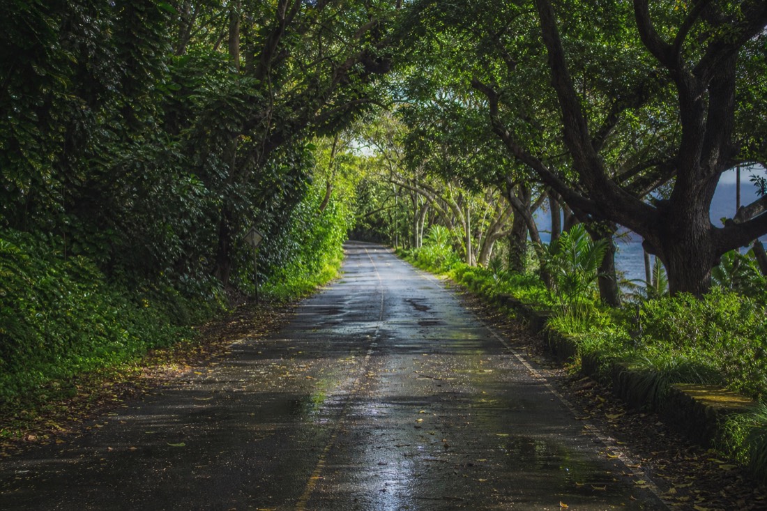
Along it sits Onomea Bay, and the Hawaiʻi Tropical Botanical Garden with its 2,000 or so plant species stacked down the hillside toward the water. You do not have to stop at the garden to be glad you took the detour. The road itself, tunnelled over by mango and African tulip trees, is the closest thing the island has to a green hallway.
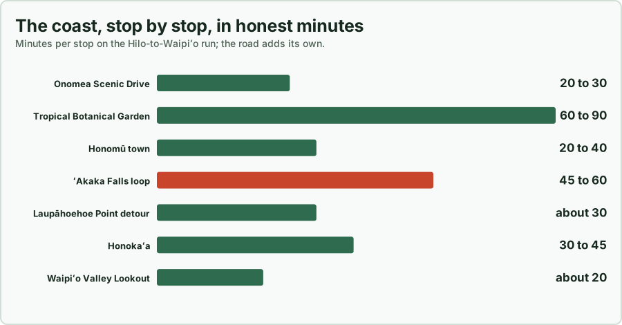
Here is how I budget the coast when guests give me a full unhurried morning.
| Stop, in order from Hilo | What it is | Honest time budget |
|---|---|---|
| Onomea Scenic Drive | Four miles of old coastal road, one-lane bridges, bay views | 20 to 30 minutes driven slow, no stops |
| Hawaiʻi Tropical Botanical Garden | 2,000 species down a hillside to Onomea Bay | 60 to 90 minutes if you go in |
| Honomū town | Two blocks of plantation-era wooden storefronts | 20 to 40 minutes, more if you eat |
| ʻAkaka Falls State Park | The 442-foot headliner, 0.4-mile paved loop | 45 to 60 minutes including the full loop |
| Laupāhoehoe Point | Sea cliffs, tide pools, the 1946 tsunami memorial ground | 30 minutes, it is a detour down a switchback |
| Honokaʻa | Old sugar town, shops, malasadas at Tex Drive Inn | 30 to 45 minutes |
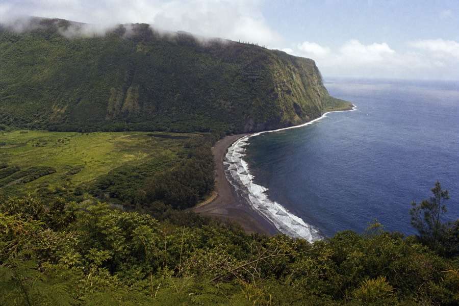
| Waipiʻo Valley Lookout | Black sand beach and valley walls from above | 20 minutes at the rail |
That full list is a day, not a morning. Most people should pick: the scenic drive, Honomū and the falls as the core, then either Laupāhoehoe or the Waipiʻo run depending on appetite. I go deeper on the northern half in Waipiʻo Valley and the Hamakua Coast.
Honomū, the town the falls road runs through
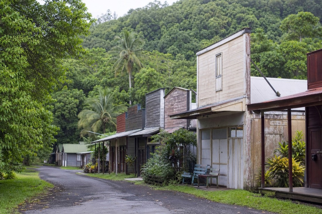
Three and a half miles before the park, Highway 220 passes through Honomū, and I beg you not to treat it as an obstacle between you and the parking lot. It is a strip of weathered wooden storefronts with tin roofs and tall false fronts, the kind of town the sugar industry built a hundred of along this coast and time has taken most of. A few galleries, a bakery smell in the morning, chickens with strong opinions. Ten minutes of walking it changes how the falls land, because you arrive understanding the falls have a neighborhood.
From Honomū the falls road climbs 3.6 miles through cane-gone-wild and eucalyptus to the end of Highway 220, where the state park waits with its card-only fee machines, $5 a head and $10 for the car if you are not a resident. If the falls themselves are the part you are planning around, the morning-at-the-falls piece covers why 8:30 is the hour to aim for.
Here is the part nobody warns you about: the falls stop is short and the coast is long. Even the unhurried version has you back in the car within an hour of the lookout, which is why the driven days that include this coastline tend to build the falls in as one beat among five or six. If you would rather have the whole coast narrated than navigate the bridges yourself, the circle-island day covers this stretch alongside the volcano and the black sand coast.
The sugar coast underneath all that green
Every gulch you cross, and you will cross a lot of them, is part of the story. The official tourism material puts it plainly: for most of the 19th and 20th centuries this coast was covered in sugar cane, and the towns, the rail cuts, the flumes and the bridges all existed to move it. The coast gets close to 84 inches of rain a year, which is why cane loved it and why everything the industry abandoned has vanished under vines.
| What you see today | What it was |
|---|---|
| Honomū's false-front main street | A plantation service town for the surrounding cane fields |
| Deep roadside gulches with waterfalls | The stream cuts that fed the flumes and watered the fields |
| The Laupāhoehoe Train Museum | A stop honoring the Hawaiʻi Consolidated Railway that hauled cane and people along this coast |
| Small farms of taro, fruit and hearts of palm | Cane land, replanted by the small growers who came after the mills closed |
| Honokaʻa's storefronts and Saturday market | One of the sugar towns that survived by becoming a real town |
I am giving you the short version; the Heritage Corridor route exists precisely to string these together, and it is the rare official driving itinerary I actually hand to guests unedited.
How long the coast really takes, and what people get wrong
Plan on three hours minimum from Hilo to the Waipiʻo lookout if you stop at all, and five if you want Honomū, the falls loop and Laupāhoehoe with lunch. It is 11 miles from Hilo to the falls turnoff and roughly 50 to Waipiʻo, but the number that matters is the stopping, not the distance.
The mistake I watch people make is treating the map distance as the time budget. Fifty miles reads like an hour. On this coast it is not, because the road drops into and climbs out of gulch after gulch, the scenic detour is deliberately slow, and every third pullout has something in it worth ten minutes. Guests who booked a 2pm activity in Kona have missed it more than once by underestimating this drive.
The second mistake is the return leg. From Waipiʻo back to a Kona resort is roughly two hours on the Saddle or the northern route, in fading light, after a full day. That is the drive people remember badly. If your bed is on the Kona side, the sane version is to let someone else own both legs and spend the daylight looking out the window, which is exactly what the Kona-to-falls guide works through in detail.
Where the vans stop, and where your own car can
I will be straight about the trade, since this site earns its keep recommending the driven versions of this day. A tour van runs the coast on a schedule. It will give you the falls, usually a photo stop or two, and a guide narrating the sugar story while somebody else handles the one-lane bridges. What it will not do is idle in Honomū for forty minutes because you found a gallery, or dive down the Laupāhoehoe switchback on a whim.
| Self-drive | Typical waterfall day tour | |
|---|---|---|
| Onomea Scenic Drive | Yours, as slow as you like | Sometimes driven through, routes vary, no lingering |
| Honomū browsing | Unlimited | Brief, if the routing allows a stop |
| Time at ʻAkaka Falls | Open-ended | About 35 to 40 minutes on the Kona days, a full hour on the longest Hilo day |
| Laupāhoehoe Point | Easy detour | Not on the standard routes I send people to |
| Who does the 90-minute Kona crossing | You, twice | The driver, while you look out the window |
| The sugar-coast story | Whatever you read up on | Narrated by a guide the whole way |
So the honest sorting is: staying in Hilo with a rental car, drive it yourself, full stop. Staying in Kona, be realistic about seven-plus hours of round-trip driving on top of the stops. That is the case where the driven day earns its price, and the Kona waterfall day is the version of this exact coastline I point people to, admission handled and Waipiʻo Lookout included; you can see what it costs on your dates before deciding.
Staying in Hilo and still not driving? That happens more than you would think, usually because one person in the group does not want to spend a holiday behind the wheel. The Hilo-based days run a shorter loop, get more time at the falls, and hand you back the afternoon. If that is your situation, the Hilo departure with the longest stop at the falls is where I would start.
Either way, do not let the waterfall bully the coastline out of your day. The falls take your breath for ten minutes. The drive works on you for hours, and it is the part of the Big Island that still looks like the century before last, if the century before last had better pavement. When you have the sequencing question sorted, the perfect ʻAkaka Falls day puts the whole thing in order.
Days that drive this coast
Big Island in a Day circle tour
About 11 hours
from $276per person, varies by date Check availability →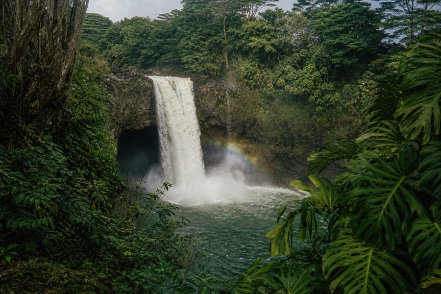
Akaka Falls, Volcanoes & Hilo day (full hour at the falls)
7 to 8 hours
from $179per person, varies by date Check availability →