Waipio Valley and the Hamakua Coast: The Drive Worth Slowing Down For
Forty miles of gulches, gardens and one sacred valley you can no longer walk into. Here is how to do it right.
 Verified by Kekoa Kalani, Akaka Falls tour guide and island nature specialist
Short answer
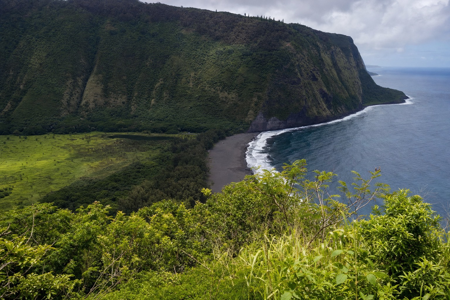
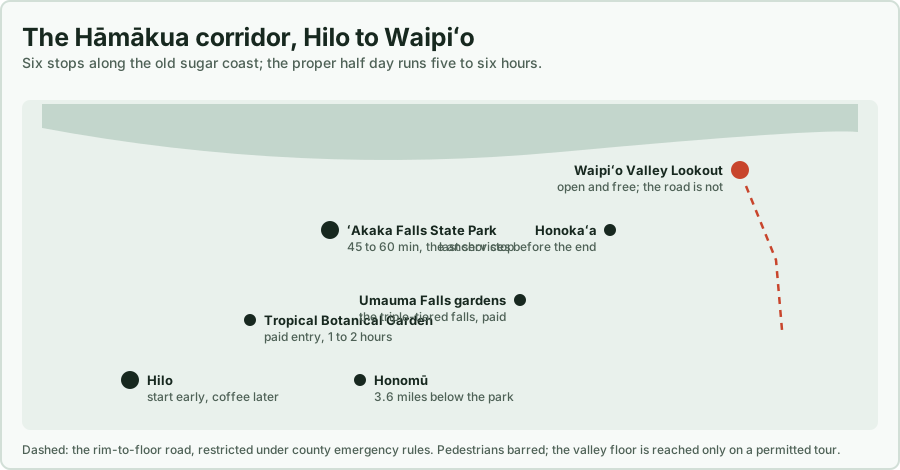
The Waipiʻo Valley Lookout is open and free, but the valley floor is restricted: Hawaiʻi County's emergency rules keep the road limited to county residents, permitted operators and Native Hawaiians exercising traditional rights, and all pedestrians are barred, so walking down is not allowed. For visitors, the lookout plus the Hamakua Coast stops make a superb half day north of ʻAkaka Falls.
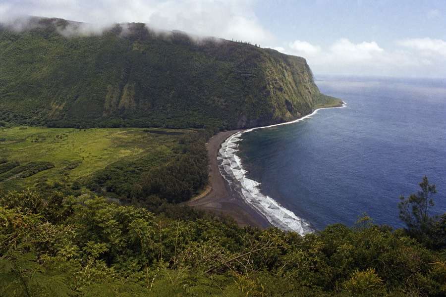
The first time I stood at the Waipiʻo Valley Lookout with guests, nobody spoke for a full minute, and that almost never happens on a tour van. The cliffs drop away in green walls, the valley floor spreads flat and dark toward a grey shoreline, and you understand immediately why this place mattered. The state tourism office puts it plainly: Waipiʻo was the boyhood home of King Kamehameha I and an important center for political and religious life in Hawaiʻi. It is a sacred place, and it asks to be treated like one.
It also sits at the end of the best drive on the island's windward side. The Hamakua Coast between Hilo and the lookout is the stretch I know best, because ʻAkaka Falls sits right on it and I have driven the road several hundred times since 2015. This guide is how I would hand that drive to a friend: what is open, what is not, what deserves a stop, and where the day usually goes wrong.
Can you go down into Waipiʻo Valley right now?
Not on your own. Hawaiʻi County's emergency rules limit the steep access road to county residents, permitted licensed and insured tour operators, and Native Hawaiians exercising traditional or customary rights. All pedestrians are barred, so hiking down is off the table. The lookout itself stays open and free.
This deserves precision, because outdated blog posts still describe walking down as if it were a pleasant morning's exercise. The road has been closed to general visitor traffic since February 2022, when the county first acted on safety grounds, and the emergency rule has been renewed continuously ever since. The current version, the twenty-fourth amended declaration, was signed at the start of July 2026 and runs into early September 2026. Rules on this cadence get renewed and occasionally reworded, so check the county's current notice before you build any plan around the valley floor.
What the rule actually says matters, because people hear "closed" and assume there is a loophole for a rental jeep. There is not. Vehicular access is limited to the groups named above, the vehicle must be low-range four-wheel drive with the drive engaged continuously, all-wheel drive does not qualify, gross vehicle weight is capped, everyone must be seated and belted, and downhill traffic yields to uphill traffic. Pedestrians, uncovered vehicles including ATVs, and horseback access are prohibited outright, with no carve-out for residents, tour guests or hikers heading for the trails beyond the valley.
The reasons are not bureaucratic. The road drops roughly 800 feet in under a mile and is signed at a 25 percent grade, which puts it among the steepest public roads in the country. It has no shoulders and no troughs to catch falling rock, the surface turns slippery after heavy rain, and the stormwater infrastructure is not adequate for the volume this coast delivers. I have driven plenty of rough roads on this island. That one earns its reputation.
| Question | Lookout | Valley floor |
|---|---|---|
| Open to visitors? | Yes, open and free | Only on a permitted tour |
| Can you drive yourself? | Yes, to the lookout lot | No, restricted road |
| Can you walk down? | You can walk the rim area | No, all pedestrians are barred |
| Vehicle rules | Any car, normal lot | Low-range 4WD, engaged, weight capped |
| Time needed | 20 to 30 minutes | Around 90 minutes on the shuttle |
| The view | The classic postcard panorama from above | Taro fields and cliffs from inside |
My honest take after years of bringing guests here: the lookout is not a consolation prize. It is the view the postcards use, and paired with the coast drive it makes a complete morning. Respect the closures, and remember what this valley is to Hawaiians before it is anything to a camera.
What does the lookout actually give you?
A paved parking area at the end of the road, a short walk to the rail, and a panorama roughly a thousand feet above a mile-wide valley with cliffs on both sides and surf breaking on a dark shoreline. Twenty minutes is enough to see it. An hour is better if the light is moving.
People underestimate how immediate the lookout is. You park, you walk a short distance, and the whole thing is in front of you. There is no hike, no gate, no fee. That accessibility is exactly why it fills up, and the practical consequence is worth planning around: the lot fills on weekends by mid-morning, and once it does, cars start circling and the shoulder gets ugly. Arrive before ten and the problem disappears.
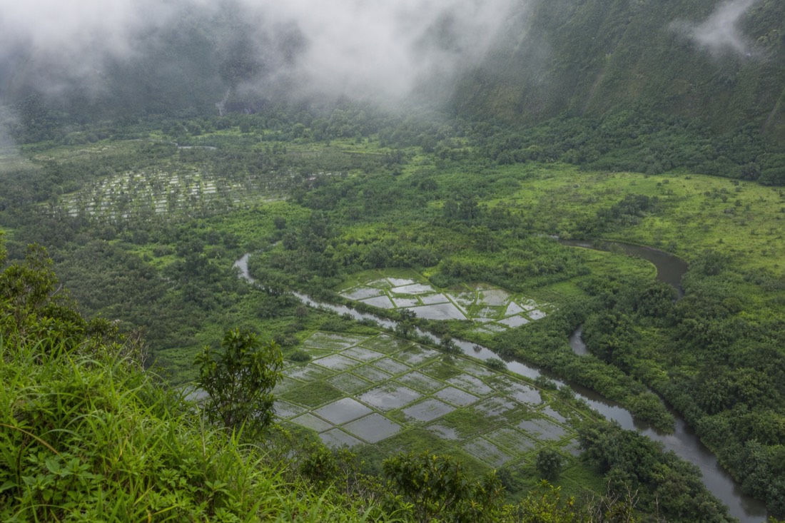
What you are looking at rewards a little patience. The valley is a working place, not a diorama. Taro grows down there, families live down there, and the stream that carved the whole thing still runs out across the beach. Cloud moves through constantly on this coast, so the view you get at 9:05am is not the view at 9:25am. I tell guests to give it three separate looks rather than one long stare, and to put the phone down for at least one of them.
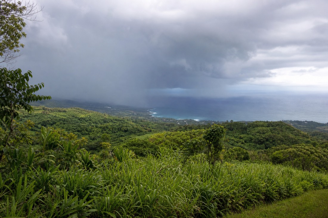
Weather is the honest variable. On a clear morning the far wall of the valley is razor sharp and you can pick out waterfalls on it. On a socked-in afternoon you can be standing at the rail seeing a wall of grey. Neither is rare. Mornings break clearer than afternoons up here for the same reason they do at the falls, which I explain in the best time to visit guide. If you get grey, wait fifteen minutes before giving up. This coast changes its mind fast.
What are the best stops between Hilo and the lookout?
Working north: ʻAkaka Falls State Park above Honomū, the Onomea scenic route and its botanical garden, the triple-tiered Umauma Falls at World Botanical Gardens, Laupāhoehoe Point, the plantation town of Honokaʻa, then the Waipiʻo Valley Lookout at the road's end. The state calls this stretch the Hāmākua Heritage Corridor.
The corridor runs from Hilo to the lookout and the tourism board describes it as a drive past scenic overlooks, waterfalls, botanical gardens and small towns. That undersells the geography. The coast pulls in nearly 84 inches of rain a year, and every inch of it shows in the green. The road crosses one-lane bridge country and old sugar land, and the towns along it reward a stop for exactly as long as a coffee takes.
ʻAkaka Falls anchors the whole run and is the reason most people are on this road in the first place. The park sits at the end of Highway 220, 3.6 miles southwest of Honomū, open daily 8:30am to 5:00pm, and the falls drop 442 feet into a stream-eroded gorge on a 0.4-mile paved loop with stair sections. Non-residents pay $5 per person plus $10 per vehicle, credit card only, and residents are free with ID. The trail guide covers the loop itself, the stairs, and the shortcut path to the main viewpoint.
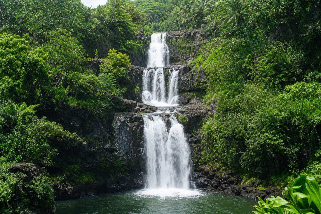
Everything else on the list is optional in the strict sense and unmissable in the practical one. The Onomea four-mile scenic route peels off the highway past mile marker 7 and drops you into jungle, one-lane bridges and a bay. Umauma Falls is a genuine triple-tier, the sort of waterfall that would be a national symbol on a smaller island and is merely a good stop here. Laupāhoehoe is where the coast tells you something true about itself, and I give it its own section below.
| Stop | What you get | Time | Notes |
|---|---|---|---|
| ʻAkaka Falls State Park | The 442-ft falls on a 0.4-mile paved loop | 45 to 60 min | $5 per person plus $10 parking for non-residents, card only |
| Honomū | Old plantation storefronts below the falls road | 15 to 30 min | 3.6 miles from the park gate |
| Onomea scenic route and garden | Jungle road, one-lane bridges, bay and boardwalk | 30 min to 2 hours | Garden has its own admission and hours |
| Umauma Falls, World Botanical Gardens | The triple-tiered falls | 45 to 90 min | Paid entry |
| Laupāhoehoe Point | Lava peninsula, hard surf, 1946 tsunami memorial | 30 min | Free, do not enter the water |
| Honokaʻa | Gateway town to Waipiʻo, shops and food | 30 to 60 min | Last real services before the lookout |
| Waipiʻo Valley Lookout | The panorama over the sacred valley | 20 to 30 min | Free, end of the road |
Why does this coast look the way it does?
Rain and sugar. Nearly 84 inches a year falls on the Hāmākua slope, which carved the gulches the highway keeps bending around and feeds every waterfall on the corridor. A century of plantation agriculture cleared and terraced the land above it, and the towns you drive through are what was left when the mills closed.
The gulches are the thing you feel first. Streams coming off Maunakea have cut deep, steep-sided ravines all the way down to the sea, and the road cannot cross them in a straight line, so it swings inland, drops, crosses a bridge, and climbs back out. That happens over and over. It is why forty miles of coast takes so much longer to drive than the map suggests, and why the drive never gets boring. Every gulch is its own small rainforest with a stream at the bottom and, after heavy rain, a waterfall you had no idea existed.
The human layer is just as visible once you know to look. Sugar drove this coast from the late nineteenth century, and Honomū's own prosperity dates from the 1876 Reciprocity Treaty between the Kingdom of Hawaiʻi and the United States, which opened the American market to Hawaiian sugar. What followed was mills, flumes, camps, railways and towns full of workers from half a dozen countries. What followed that was closure. The fields above the highway between Honomū and the park still show the shape of cane land going back to forest.
That history explains something visitors often ask about, which is why the towns feel quiet. They are not tourist villages that failed. They are working towns that lost their industry and kept their buildings, and they have been slowly finding a second life through art, food and the traffic heading for the waterfalls. Treat them as places where people live rather than as photo stops and the difference in how you are received is immediate.
What is worth stopping for in Honomū?
A row of timber-frame plantation storefronts at the junction of Highway 19 and Highway 220, holding galleries, craft shops and a couple of places to eat. It is ten minutes if you are efficient and forty if you are not, and it is the natural coffee stop before or after the falls.
Honomū sits about 11 miles north of Hilo, off Highway 19 between mile markers 13 and 14, where the turn onto Highway 220 climbs toward the park. That geography is the whole reason the town still exists in visitor consciousness: more than a million people a year pass through it on their way to the waterfall. Most of them do not stop, which is a small mistake and an easy one to correct.
What is there is modest and genuine. Mamane Street is a short row of wooden buildings from the sugar era, now holding art galleries, craft stores and food. The town once ran a gas station, a bar and two theatres when the mill was going, which tells you how much bigger it used to be. Today the pleasure is architectural and slow: old shopfronts, deep eaves for the rain, a hillside behind and the ocean below.
My routine is to stop on the way down rather than the way up. Guests are hungry after the loop, the light is better later in the morning, and nothing about Honomū improves for being visited at 8:15am on the way to a park that has not opened yet. Ten minutes here also breaks the drive nicely if you are continuing north, because the next real services are a long way up the coast at Honokaʻa.
| Town | What it is | Best for | Time |
|---|---|---|---|
| Honomū | Sugar-era storefront row at the falls junction | Coffee, galleries, a break after the loop | 15 to 30 min |
| Laupāhoehoe | Lava point below the highway with a memorial | History, surf, a quiet picnic | 30 min |
| Honokaʻa | Gateway town to Waipiʻo, shops and restaurants | Fuel, a real lunch, last services | 30 to 60 min |
What happened at Laupāhoehoe Point?
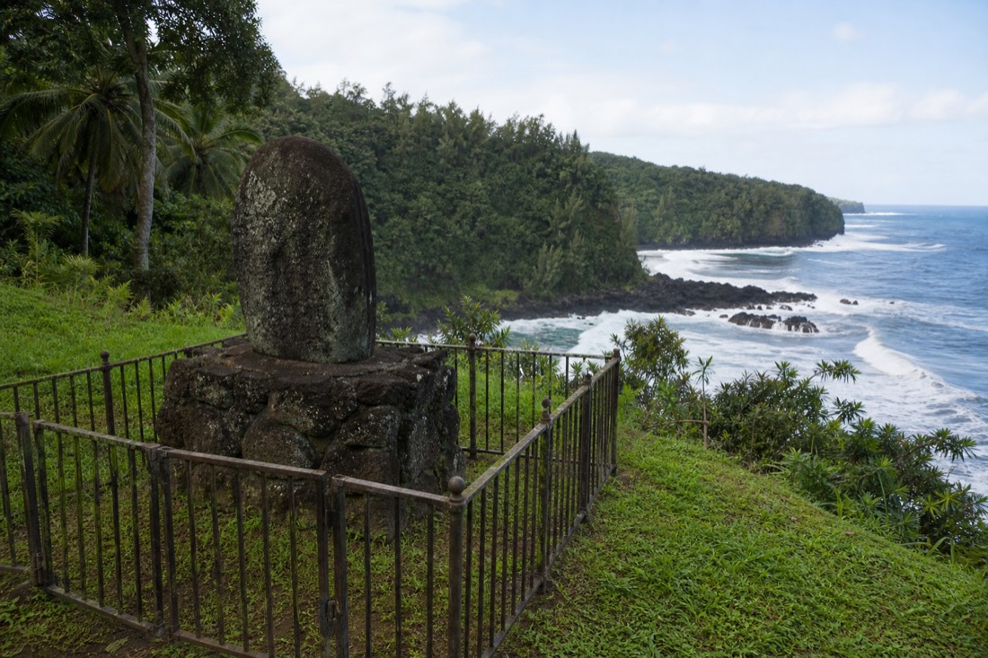
On 1 April 1946 a tsunami struck the low lava peninsula where the village school stood, killing twenty-four people, most of them children. A memorial on the knoll above the bay carries their names. The point is now a county park with grass, palms and some of the hardest surf on the coast.
Laupāhoehoe means leaf of lava, which describes the flat tongue of old flow that built the peninsula out from the cliffs. That flatness is why the school was there, and why the wave did what it did. The names and ages of the dead are engraved on a granite stone set on a lava pedestal, on a concrete platform ringed by an iron railing, looking out over the bay. Sixteen students, four teachers, and a teacher's wife and three children are among those recorded.
I bring guests here deliberately, usually after they have been to the tsunami museum in Hilo, because the two halves fit together. The museum explains the physics and the history. The point makes it local. You stand on grass twenty feet above the water, watch the swell hit the black rock, and the distance between an ordinary morning and a catastrophe collapses.
Practical notes, and I mean these. The surf hits the lava hard even on calm-looking days, the currents offshore are strong, and this is not a swimming beach in any sense. Stay well back from the wet rock, especially with children. There are grassy areas, a pavilion and picnic tables for day use, restrooms, and enough shade to make it a good place to eat the fruit you bought in Hilo. Give it half an hour, read the stone, and drive on north.
How much time should you budget for the Hamakua Coast?
A bare lookout run from Hilo takes about three hours round trip with a short stop. The real version, falls plus two coast stops plus Honokaʻa and the lookout, wants six to seven hours. From Kona, treat it as a full day no matter how you slice it, because you are crossing the island twice.
Time is the thing people misjudge on this coast, and it is almost always the gulches that do it. The mileage looks short. The road is not slow exactly, but every gulch bends the highway inland and back out, and every good stop costs more minutes than planned because the places are better than expected. Build slack into the plan and the day feels generous instead of rushed.
The other quiet time sink is the falls themselves. People allocate half an hour to ʻAkaka and then spend an hour, because the loop is short but the gorge is the sort of thing you stand in front of longer than you meant to. I have written out how long the park really takes in how much time you need at the falls, and the honest answer there shapes everything downstream on this drive.
| Plan | Route | Honest time | Verdict |
|---|---|---|---|
| Lookout sprint | Hilo to lookout and back, one stop | About 3 hours | Fine, but you will wish you had stopped more |
| The proper half day | Falls, Honomū, one garden, lookout | 5 to 6 hours | The sweet spot from a Hilo base |
| The full corridor | All seven stops at an easy pace | 7 to 8 hours | Best with an early start and packed snacks |
| From Kona, self-drive | Cross-island both ways plus the corridor | 10+ hours | Long; share the driving |
| From Kona, guided | Waterfall-focused day with a lookout stop | About 10 hours | Someone else does the 200 miles |
That last row is where a guided day genuinely earns its money, and I say that as someone who tells people all day that the falls themselves only cost $5 plus parking. Driving Kona to the Hamakua Coast and back is a lot of wheel time on roads that deserve attention. The waterfall day that starts on the resort coast handles pickup on the Kona and Kohala side, spends around forty minutes at ʻAkaka Falls with the admission covered, and stops at the Waipiʻo Valley Lookout, the lookout specifically, not the restricted floor. That distinction matters and I check it on every itinerary I recommend.
What is the drive actually like?
Two lanes, constant gulch crossings, one-lane bridges on the scenic detours, frequent rain and slow trucks. It is not technical driving, but it is attentive driving. Allow more time than the map says and pull over properly rather than stopping on the shoulder.
Highway 19 north of Hilo is a normal state highway that happens to run through spectacular country. The hazards are ordinary ones: wet surfaces, sudden showers that drop visibility, cane haul roads joining, and visitors braking hard for views. The gulch crossings are engineered and safe, though the older viaducts have a way of concentrating the mind when the ocean is directly below.
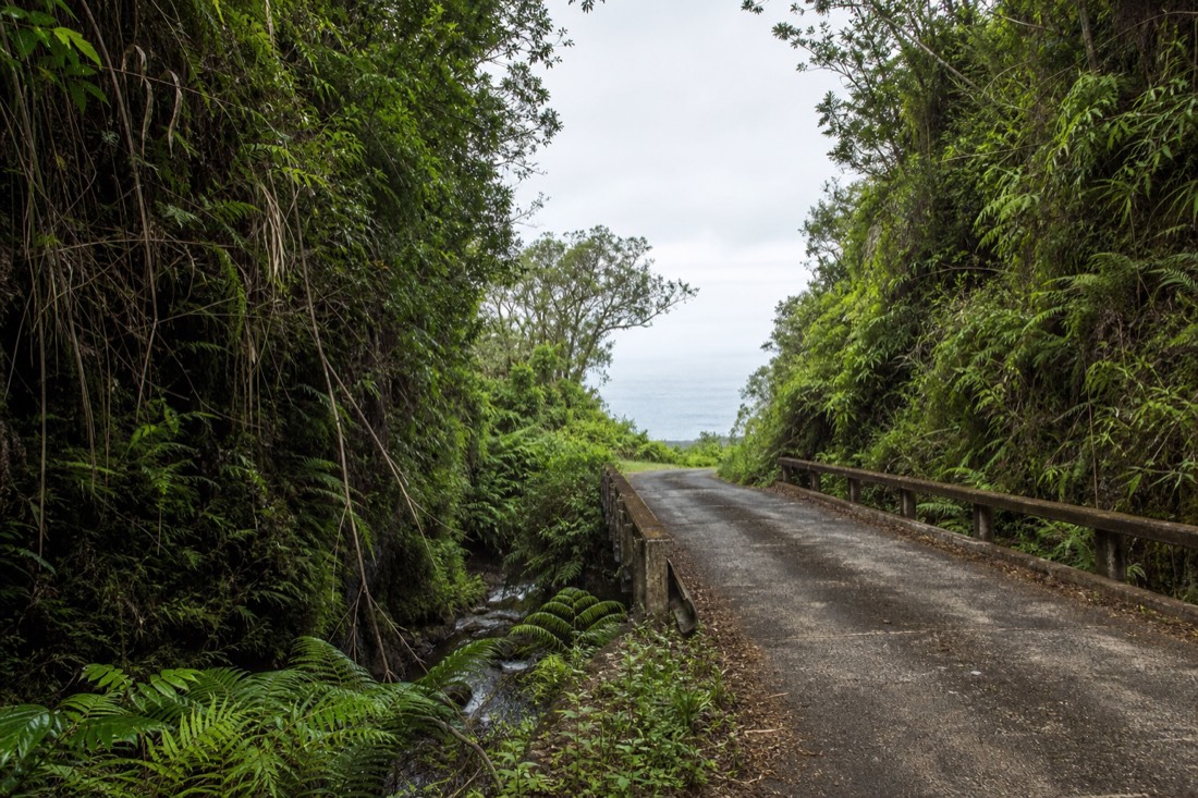
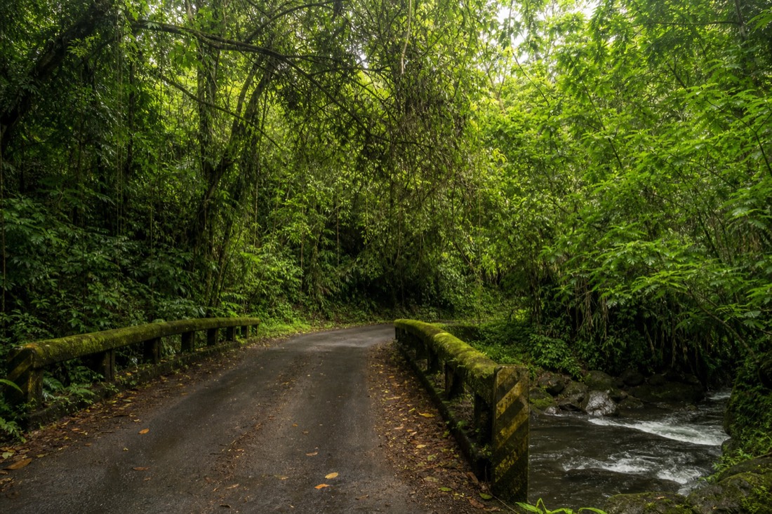
The scenic detours are a different animal and much more fun. The Onomea four-mile route drops onto the old Māmalahoa alignment, where the road narrows into jungle, crosses single-lane bridges over streams, and passes the botanical garden on Onomea Bay. Yield rules on one-lane bridges here are the usual courtesy ones, and locals will wave you through more often than not. Drive it at fifteen miles an hour with the windows down and it becomes the best twenty minutes of the day.
Two practical driving notes I give every group. First, fuel up in Hilo or Honokaʻa, not in between. Second, do not trust a phone for the last stretch to the lookout; the road is obvious once you are on it, and the signal is not. If you would rather not think about any of this, the Hilo-based day that gives you a full hour at the falls covers the waterfall end of this coast without you touching a steering wheel, and the Kona to ʻAkaka Falls guide lays out the cross-island version in full.
| Leg | Distance | Drive time | Character |
|---|---|---|---|
| Hilo to the Onomea scenic route | About 7 miles | 15 min | Straight coastal highway, gulch crossings |
| Onomea route end to Honomū | About 5 miles | 12 min | Back on the highway, cane land above |
| Honomū to ʻAkaka Falls | 3.6 miles | 10 min | Climbing spur road, tight turns near the top |
| Honomū to Laupāhoehoe | About 15 miles | 25 min | Viaducts, deep gulches, ocean on your right |
| Laupāhoehoe to Honokaʻa | About 18 miles | 30 min | Higher, drier, open pasture |
| Honokaʻa to the lookout | About 9 miles | 20 min | Narrow, rural, ends at the rim |
Should you base the drive from Hilo or from Kona?
Hilo, if you have any choice. The corridor starts at Hilo's northern edge, so a Hilo base turns this into a relaxed half day. From Kona you are adding roughly two hours of cross-island driving in each direction before the coast even begins, which pushes the same itinerary into a long full day.
The geography is unforgiving on this one. Hilo sits at the bottom of the corridor. Kona sits on the opposite coast, over or around the mountains. Whichever route you take across, you are spending the first and last chunk of the day getting to and from the part you came to see. Plenty of people do it, and it can be a great day, but it is not a half day and anyone who tells you otherwise has not driven it with a car full of tired passengers at 6pm.
If you are Kona-based and this coast is a priority, you have three sensible options. Move hotels for one night to the Hilo side and do the corridor properly the next morning. Take a guided day that absorbs the driving and picks a tight itinerary. Or accept a long day, leave before sunrise, and cut the stop list to the falls and the lookout only.
| Factor | Hilo base | Kona base |
|---|---|---|
| Drive to the corridor start | Minutes | About 2 hours each way |
| Realistic stops in one day | Five to seven | Two to three |
| Time at ʻAkaka Falls | As long as you want | Whatever the schedule leaves |
| Sunset risk on the return | None | Real, plan for it |
| Best solution | Self-drive with this page | A guided day or a night on this side |
Is the lookout alone worth the drive from the falls?
Yes. From ʻAkaka Falls it is roughly an hour more of coast road each way, and the payoff is the single best viewpoint on the windward side. If you are already standing at the falls before 10am, adding Honokaʻa and the lookout turns a good morning into the best half day on this coast.
Here is the calculation I walk guests through at the park gate. You are at the falls early, because the park opens at 8:30am and mornings are kinder. The loop takes under an hour. At that point you are already a third of the way up the corridor, the day is young, and turning south means Hilo errands while turning north means Waipiʻo. I push north almost every time the weather allows.
The counter-argument is real and I give it too. If your group has small children, if anyone is stiff after the stairs, or if the sky has already closed in, the extra two hours of driving buys a view that might be grey when you get there. In that case, go back to Hilo, take the town slowly, and use the things to do in Hilo guide instead. A grey lookout is a genuinely disappointing way to end a good morning.
For anyone with energy left after the loop and a taste for something faster, the gulch immediately west of the park is where the zipline runs, and the course that crosses above KoleKole Falls fills an afternoon well when the coast drive is a bridge too far. It is minutes from the park gate, which is the entire argument for it.
How should you behave at the rim?
Like a guest at a funeral rather than a customer at a viewpoint. Stay behind the rails, keep voices down, do not fly a drone over the valley, do not attempt the road on foot, and pack out everything. Waipiʻo is a burial ground of chiefs and a living community, not a photo backdrop.
I am blunt about this with every group, because the rim is where visitor behaviour on this island is most visibly tested. People arrive excited, they have driven a long way, and the temptation to push past a barrier for a better angle is strong. Do not. The county rule barring pedestrians is not a suggestion, and the residents below have watched a decade of strangers treating their home as a challenge to be beaten.
There is a cultural dimension that matters more than the legal one. Waipiʻo held political and religious authority for centuries, it was home to Kamehameha I as a boy, and it holds burials. Hawaiian tradition treats storied places as having presence rather than merely history. You do not have to share that belief to act as if you do, and the visit is better for it. The same instinct applies at the falls, and I write about where it comes from in the legend and song guide.
Practically, that means a few small things. Park in the lot rather than the shoulder. Give other people room at the rail instead of holding the best spot for a photo series. Take rubbish away with you, including fruit peel. And if you meet a resident coming up the road in a truck, get out of the way and wave. It costs nothing and it is the entire difference between being welcome and being tolerated.
What should you do if the weather closes in?
Keep going, but reorder. Rain on this coast is normal, it usually moves through within the hour, and it makes every waterfall on the corridor better. Swap the lookout to later in the day, take the gardens or the towns while it is heaviest, and give the rim a second attempt before you turn for home.
The mistake is treating a shower as a verdict. This slope takes nearly 84 inches a year and still spends most days partly bright, which tells you how much of that rain arrives in short bursts. I have watched a group write off the lookout at 10am and then stand in clear sunshine at the same rail at 1pm. Build a loop into your plan rather than a straight line and the weather stops being a problem.
What does change in heavy rain is what is worth doing. Waterfalls improve. Views deteriorate. Gardens are pleasant in light rain and miserable in a downpour. Town stops become the obvious move: Honomū's storefronts have deep eaves, Honokaʻa has real indoor space, and both are better with a coffee than a camera. The falls themselves stay in the plan whatever happens, since the loop is paved and I walk it in rain most weeks of the year. Rain at the falls covers what the trail is actually like when it is wet.
The drive gets called scenic, which is true and far too small a word. Slowed down and taken properly, with the falls at the start and the rim at the end, it is closer to a pilgrimage, and the waterfalls guide can fill whatever daylight you have left on the way home. Waipiʻo will still be there next time, and it will still ask the same thing of you: arrive quietly, look for longer than feels natural, and leave it exactly as you found it.
Coast days that reach the lookout
Big Island in a Day circle tour
About 11 hours
from $276per person, varies by date Check availability →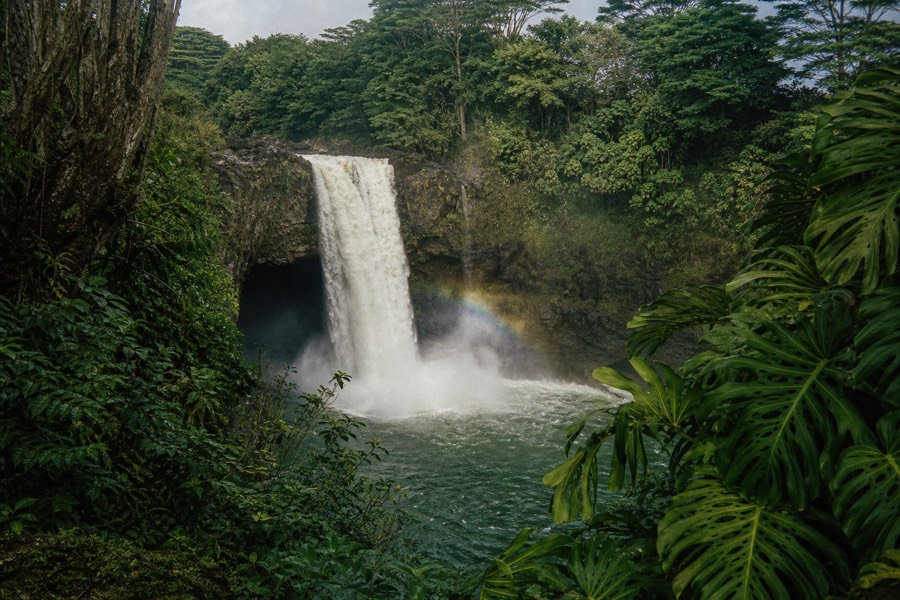
Akaka Falls, Volcanoes & Hilo day (full hour at the falls)
7 to 8 hours
from $179per person, varies by date Check availability →